DE
EN

Settlement Layout

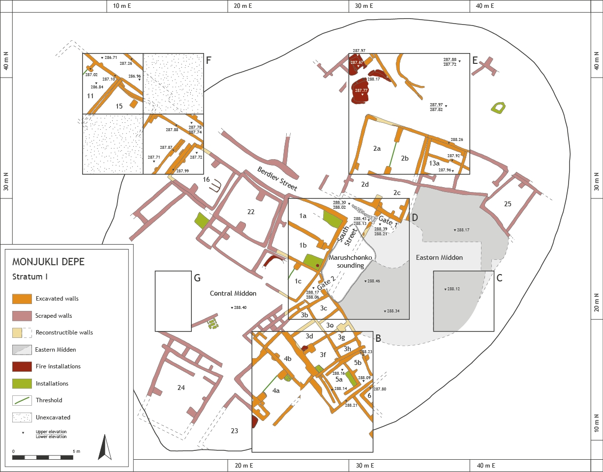
A plan of Stratum I, the latest Meana Horizon occupation level.

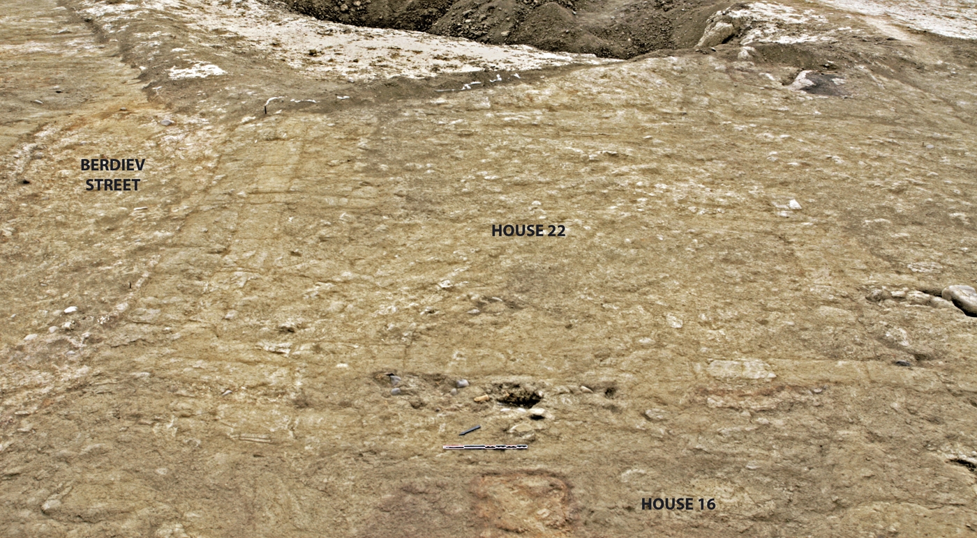
The layout of the Meana Horizon village at Monjuki Depe is best attested for the most recent settlement phases, Strata I and II. In addition to the large excavated exposures of these upper levels in Units B, D, E, and F, we confirmed, in some cases modified, and also extended the plan of the site originally published by O. Berdiev. For this, we used "scraping," a technique whereby the upper centimeters of sediment on the mound's surface are removed over relatively large areas by means of broad-bladed hoes.

The Aeneolithic village layout is characterized by dense, regular construction in comparison to Neolithic sites in the region. The Aeneolithic settlement was organized around straight paths and open areas. Houses were nearly square and built close to one another, in many cases directly up against the next house, although they did not share walls. With only few exceptions, they were oriented in a similar way, with the four corners pointing toward the cardinal directions.
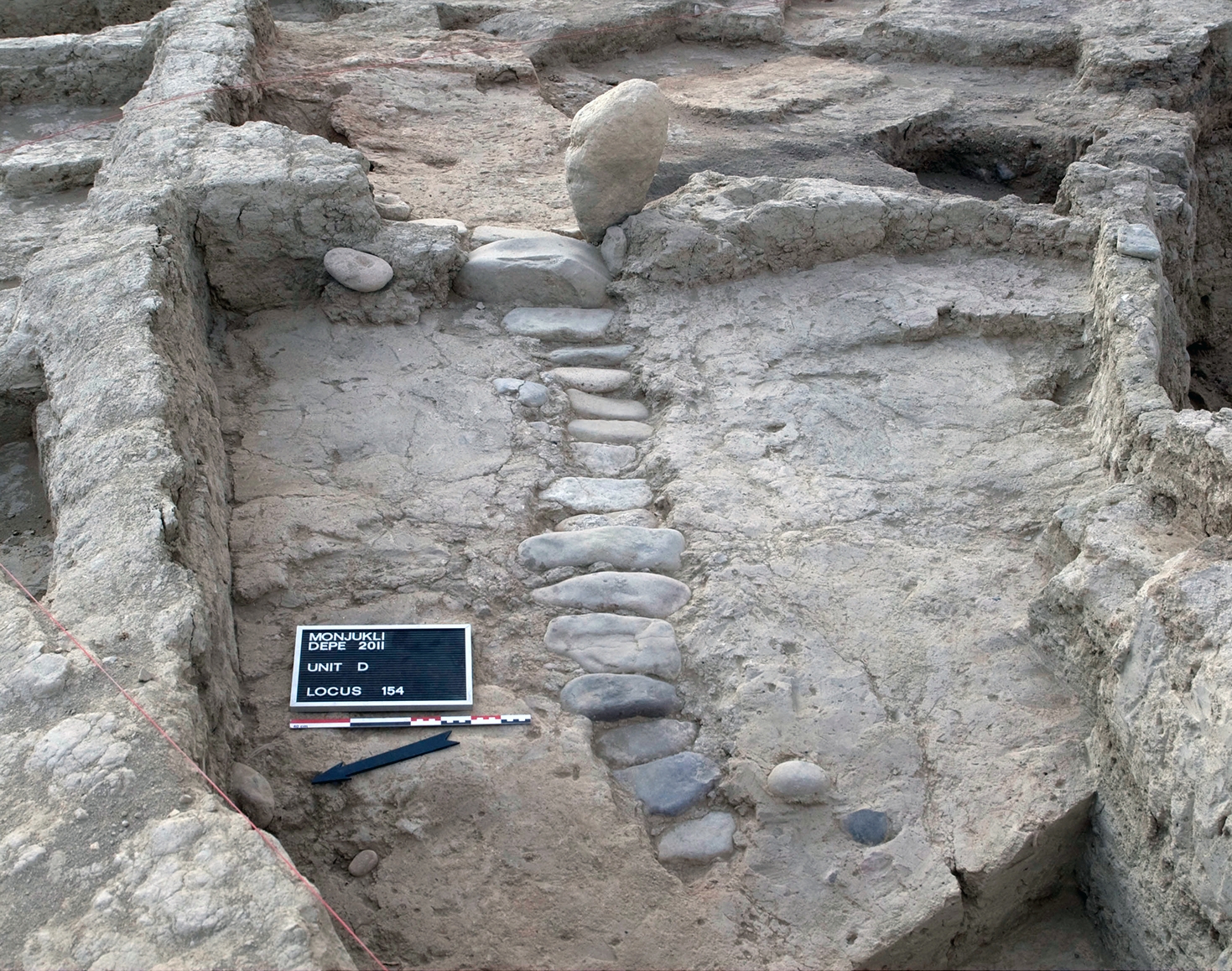
 

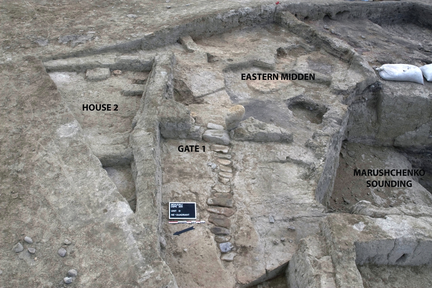
Gate 1 at the end of Berdiev Street. In one phase of its use, the street was partially paved with stones. Behind the gate lies the Eastern Midden.

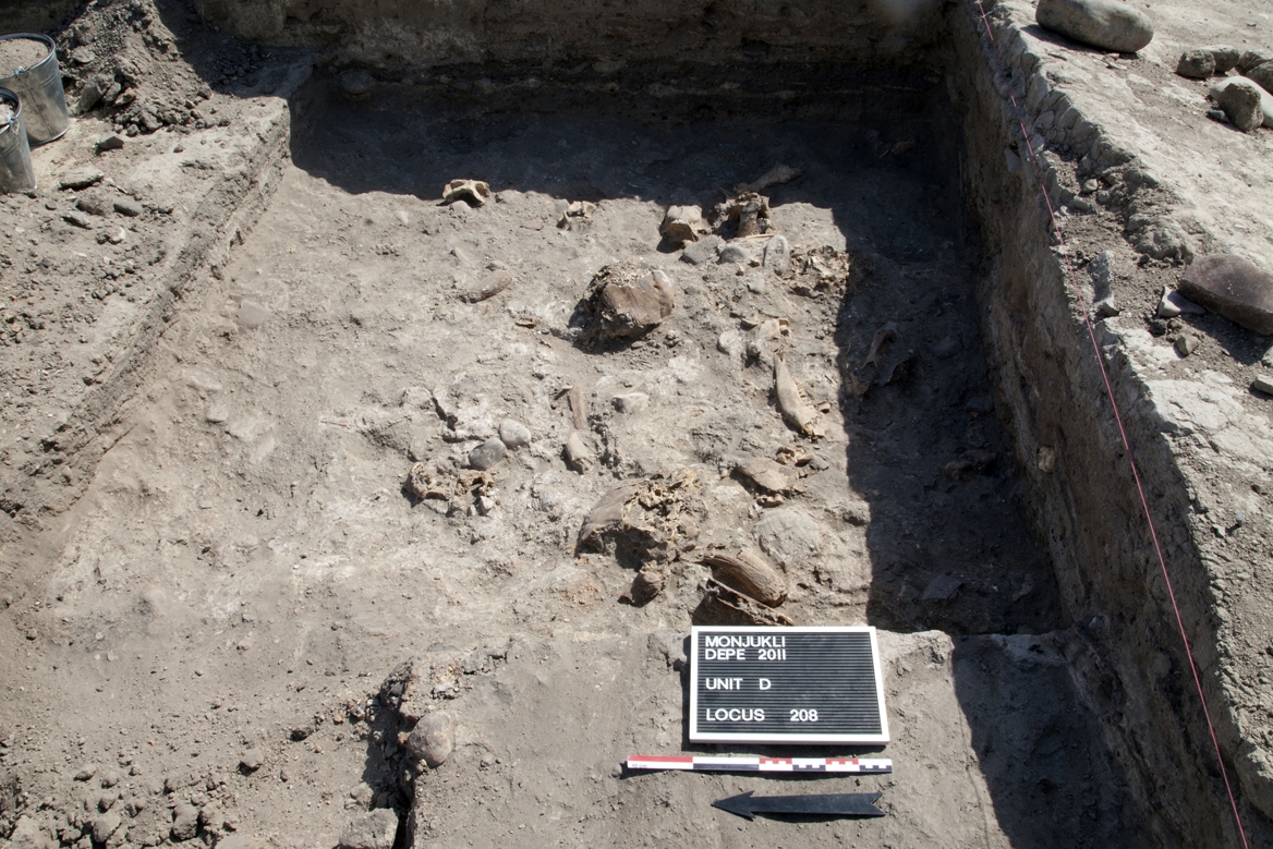
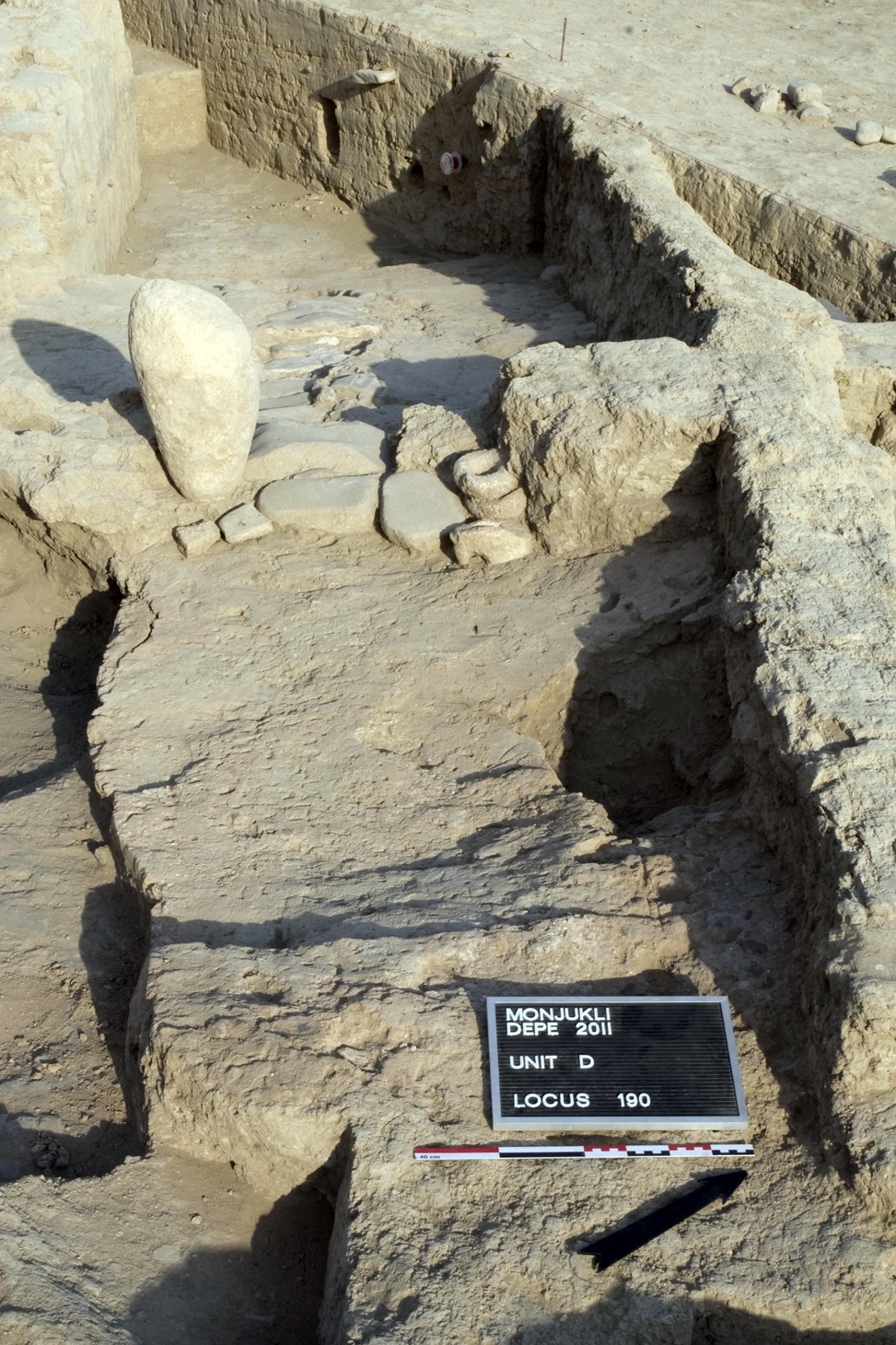
A path through the village, already recognized in the earlier Soviet excavations, was dubbed by us "Berdiev Street." It runs in a northwest-southeast direction, ending abruptly in the eastern portion of the site. There it rises slightly. In the middle the street was paved with a row of stones, and at its end a single, large standing (lime) stone marks a former gate. This gate had a single-leaf door, as shown by the presence of a door socket on the other side of the doorway. Around the gate, both in the street area to the west as well as to the east of the gate, there were several more door sockets, which make clear that this eastern area containing the so-called Eastern Midden was meant to be closed off. The midden was an open yard with massive accumulations of ash in which an abundance of animal bones as well as tokens, animal figurines, and fired as well as unfired pottery were found. Based on the analysis of the faunal remains, this area seems to have been used for the deposition of butchery waste from feasting events.

The so-called "South Street" also led toward the gate. It ran in a southwest-northeast direction along a wall that formed the western border of the Eastern Midden. At its southwestern end was another, much simpler gate area that may have regulated access to the "Central Midden" to the south of House 1. At least six houses were located around this ash-filled outdoor space, and the residents probably used the midden collectively. A similar communal use may have characterized the open area to the north of House 2 in which several fire installations were located. Whether a similar internal layout with straight paths existed in the earlier Aeneolithic phases cannot be ascertained.


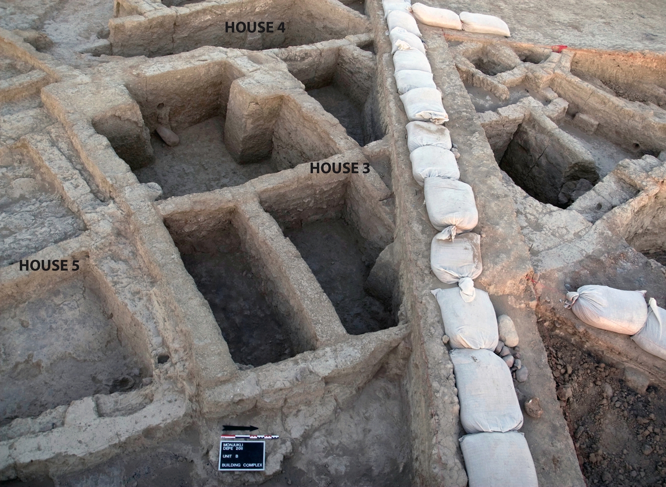
An overview of a portion of the excavation at the end of the 2011 season. A part of House 2, Berdiev Street, and Gate 1 are visible in the lower right corner. Behind them is House 1, of which only the north-eastern corner remains visible. Houses 3 and 4 can be seen on the left side of the photo.

The Central Midden may have existed in the earlier phases, in contrast to the Eastern Midden, which was located in an area that contained buildings until the end of Stratum III. In spite of these changes in which houses were succeeded by open spaces or the other way around, the Aeneolithic settlement is characterized by a certain continuity. Some houses were built directly above one another (for example, the sequence House 20, House 9, and finally House 1), whereas Houses 3 and 4 were used for nearly the entire period of the Aeneolithic settlement, despite temporary abandonment phases.


For further reading, see Pollock et al. 2011; Pollock et al. 2013; Chapter 2 in Pollock et al. (eds.) 2019; Heit in preparation.
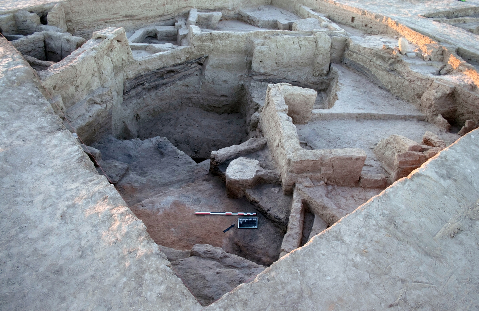
A view of Unit D at the end of excavation in 2012. In the foreground is House 14, filled with burnt debris, to the right House 10, in the background House 9, and in the back left corner of the picture a portion of House 3.
The area of Gate 1, at the end of Berdiev Street. The large, standing limestone boulder marks one side of the gate. An array of door sockets and grinding stones were placed at and around the threshold, pointing to its symbolic as well as functional importance.
Overview of adjacent houses in Units B and D. Note that in the later phase of House 3, visible here, the original single room was divided into seven small cubicles by means of partition walls.
A view of a portion of the Eastern Midden. Numerous animal bones, some still in articulation were discarded in the midden together with large quantities of ash.
The location of the Eastern Midden in relation to Gate 1 and the partially paved street leading up to the gate. House 2 borders the street on its north side. The deep sounding excavated by A. Marushchenko is visible on the righthand portion of the picture.
House 22 and a portion of House 16 as revealed by scraping. Both houses border directly on Berdiev Street. In the background is the backfilled Unit D.